
Show Cases
OGC standards are technical documents that detail interfaces or encodings. Software developers use these documents to build open interfaces and encodings into their products and services.
TAIWAN
Debris Flow Monitoring System
Established in 2002 by GIS.FCU, the Debris Monitoring System offers a central hub for debris flow monitoring and disaster response. It aids decision makers during typhoons by providing vital local data. The system manages various sensor data, including rain gauges and CCD cameras. It utilizes the Sensor Observation Service (SOS) from the Open Geospatial Consortium for data exchange. A code generator by GIS.FCU produces SOS-compatible XML, enabling easy online access to CCD images. The future plan includes incorporating rain gauge data using the same SOS standard, aiming for Taiwan’s monitoring networks’ interoperability.
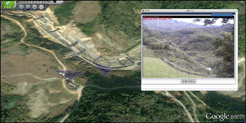
Example of sensor status and CCD image of a monitoring station
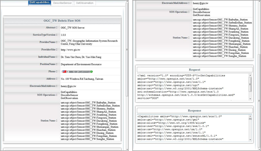
Example of the sensor (CCD camera) information and XML of SOS GetCapabilities function
TAIWAN
Integration Platform for River Monitoring and Management Systems
The government addresses river management by establishing monitoring systems. The Water Resources Agency (WRA) developed an integrated platform in 2011 to manage data from local River Management Offices (RMOs). Utilizing OGC SOS standards, the platform enables seamless communication and data sharing between RMOs and WRA. The system detects anomalies, automatically analyzing CCD images to identify intrusions or unusual activities along rivers. Alerts are generated for swift responses. The successful integration showcases the potential of a unified interface for river management, enhancing disaster response during typhoons and rainy seasons while fostering basin-wide monitoring capabilities.
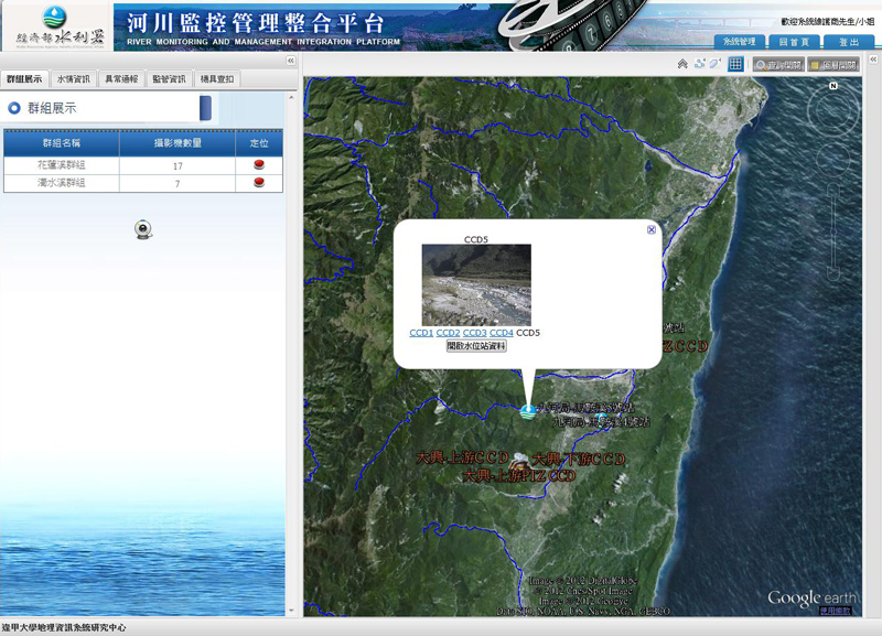
Example of real-time image for a specific CCD camera
(the area is at Hualien County)
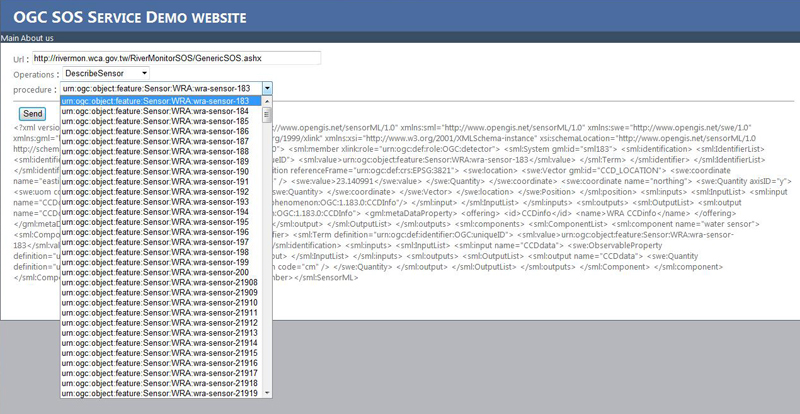
Sensor selection for SOS DescribeSensor service


About GIS.FCU
Since 2008, GIS.FCU has participated in the development of standards and cooperation plans with major global organizations such as NASA, Google, and ESRI as a Principal member, and the establishment of OGC Asia Forum (OGC Asia Forum) to lead the Asian standards conference, to promote the development and application of space information.